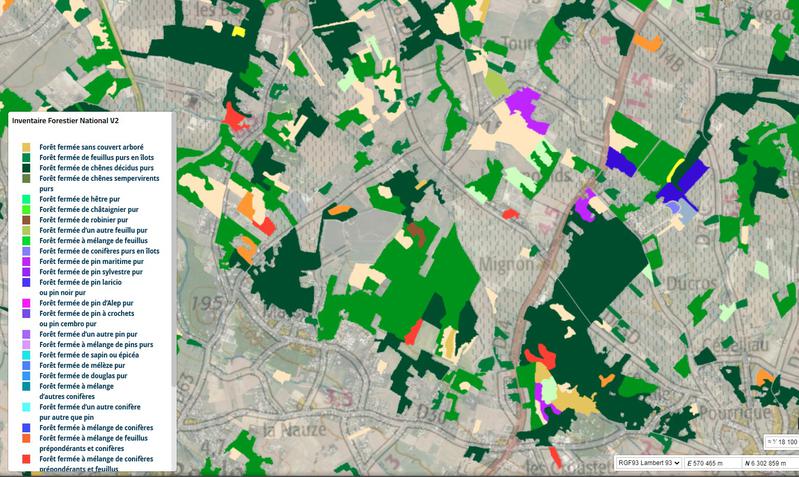
Une couche sur l'inventaire forestier national est…
Visualization
Published on September 2, 2022 by Géofoncier
This is a degraded experience of data.gouv.fr. Please enable JavaScript and use an up to date browser.
Archived
La parcelle forestière est une partie de forêt utilisée comme cadre de référence géographique pour la gestion et matérialisée sur le terrain.Les parcelles forestières forment un découpage exhaustif de la forêt.
Origine
Couche obtenue par géotraitement de la couche nationale partenaires.
Organisations partenaires
Office National des Forêts
Liens annexes
⚠️ This dataset is handled by the geo.data.gouv.fr platform. This platform is not actively maintained and as a result, you may find some bogus data or metadata. More information about the shutdown of geo.data.gouv.fr is available here.
September 23, 2020
Licence Ouverte / Open Licence version 2.0
Data description filled
Files documented
License filled
Update frequency not set
File formats are open
Temporal coverage not set
Spatial coverage not set
All files are available
Update frequency not set
Temporal coverage not set
Spatial coverage not set
Visualization
Published on September 2, 2022 by Géofoncier
There are no discussions for this dataset yet.
There are no community resources for this dataset yet.
5c9a0c4d634f412166d2877a
March 26, 2019
Unknown
September 23, 2020
fr-662043116-82880F0D-E1C4-4EF3-80AF-416977F118F1
80ae3ad8d114ea35b08270e1a01caaa2727618cf
http://metadata.carmencarto.fr/geonetwork/105/metadata/fr-662043116-82880F0D-E1C4-4EF3-80AF-416977F118F1
shutdown-phase-2
4.1k
4.7k
1
1