Archived
Ports appartenant à la région Bretagne
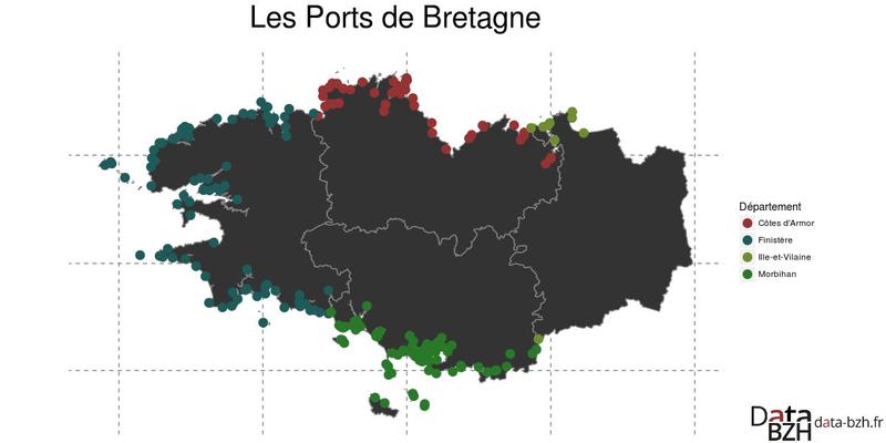
Description
Cette couche contient le positionnement des ports appartenant à la région suite au transfert de certains ports départementaux en 2017.
Origine
Les ports ont été localisés grâce à la base des ports de Bretagne datant de 2016 dont les points ont été positionnés grâce à deux référentiels : - les contours de la BDCARTO (IGN) pour que les points restent à l'intérieur du polygone de chaque commune ; - le SCAN25 (IGN) pour les positionner de la façon la plus précise possible.
Organisations partenaires
Région Bretagne
Liens annexes
Producer
⚠️ This dataset is handled by the geo.data.gouv.fr platform. This platform is not actively maintained and as a result, you may find some bogus data or metadata. More information about the shutdown of geo.data.gouv.fr is available here.
Latest update
February 23, 2020
License
Licence Ouverte / Open Licence version 2.0
Metadata quality:
Data description filled
Files documented
License filled
Update frequency not set
File formats are open
Temporal coverage not set
Spatial coverage filled
All files are available
Metadata quality
Update frequency not set
Temporal coverage not set
1 Reuse
There are no discussions for this dataset yet.
There are no community resources for this dataset yet.
Information
Tags
ID
559b9272c751df277b390bd3
Temporality
Creation
July 7, 2015
Frequency
Unknown
Latest update
February 23, 2020
Spatial coverage
Territorial coverage granularity
Other
Actions
Embed
Extras
inspire:resource_identifier
https://kartenn.region-bretagne.fr/geonetwork/srv/fre/xml.metadata.get?uuid=c55c4fba-6a37-48ea-8754-a1bf770a684b
geop:dataset_id
12678f24655de4a5472ef7ae76a507cbdd01ad8a
inspire:identifier
c55c4fba-6a37-48ea-8754-a1bf770a684b
geop:archived
shutdown-phase-2
Statistics for the year
Views
611
Downloads
178
Reuses of this dataset
1
Followers
0