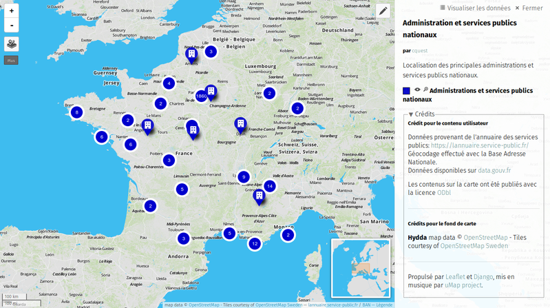

Annuaire des services publics nationaux
From Christian Quest
La DILA diffuse officiellement depuis mai 2016 ces données sur https://www.data.gouv.fr/fr/datasets/referentiel-de-lorganisation-administrative-de-letat/ Extraction des données de l'annuaire des services publics concernant les administrations et services publics nationaux. Ce fichier vient…
Metadata quality:
Data description filled
Files documented
License filled
Update frequency followed
File formats are open
Temporal coverage not set
Spatial coverage filled
All files are available
Updated on 14 de febrero de 2016