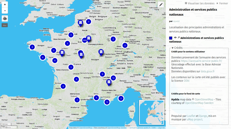

Annuaire des services publics nationaux
From Christian Quest
La DILA diffuse officiellement depuis mai 2016 ces données sur https://www.data.gouv.fr/fr/datasets/referentiel-de-lorganisation-administrative-de-letat/ Extraction des données de l'annuaire des services publics concernant les administrations et services publics nationaux. Ce fichier vient…
Metadata quality:
Data description filled
Files documented
License filled
Update frequency followed
File formats are open
Temporal coverage not set
Spatial coverage filled
All files are available
Updated on February 14, 2016