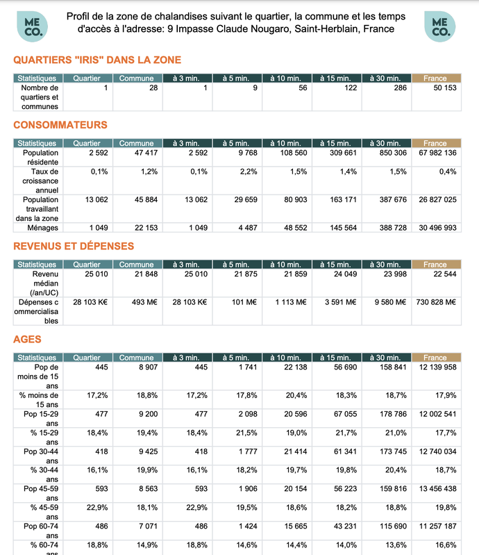
Données de zone de chalandise
Application
Published on April 12, 2024 by MECO - MonEmplacementCommercial.fr
This is a degraded experience of data.gouv.fr. Please enable JavaScript and use an up to date browser.
Coédition INSEE et IGN, Contours...Iris® est un fond numérisé des îlots Iris définis par l'INSEE pour les besoins des recensements sur l'ensemble des communes de plus de 10 000 habitants et la plupart des communes de 5 000 à 10 000 habitants.
October 21, 2016
Licence Ouverte / Open Licence
Data description filled
Files documentation missing
License filled
Update frequency not followed
File formats are open
Temporal coverage not set
Spatial coverage filled
Some files are unavailable
Files documentation missing
Update frequency not followed
Temporal coverage not set
Some files are unavailable
Application
Published on April 12, 2024 by MECO - MonEmplacementCommercial.fr
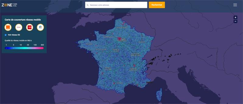
Application
Published on September 19, 2023 by Zone ADSL&Fibre Data
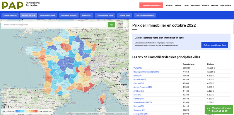
Application
Published on October 28, 2022 by DE PARTICULIER A PARTICULIER - EDITIONS NERESSIS
Application
Published on October 5, 2022 by Hadrien LECLERC

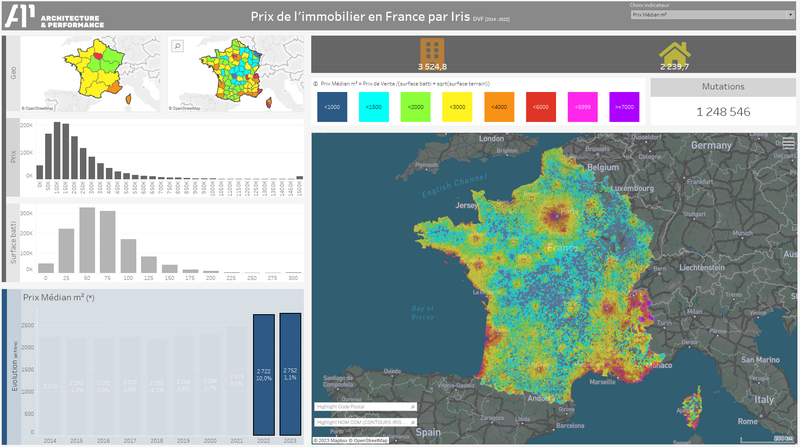
Visualization
Published on September 11, 2021 by Architecture & Performance

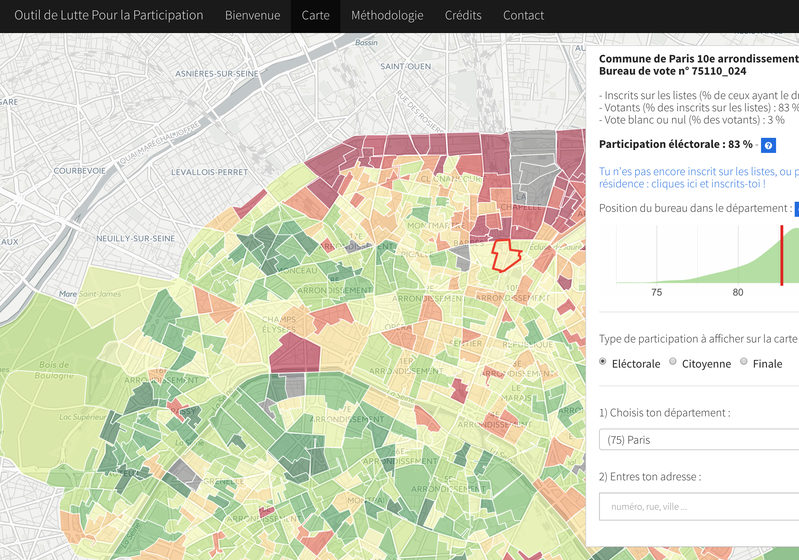
Application
Published on November 16, 2016 by Stanislas de La Rivière
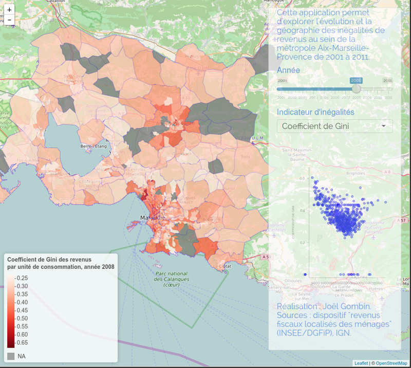
News Article
Published on September 16, 2016 by Joel Gombin
There are no discussions for this dataset yet.
These resources are published by the community and the producer isn't responsible for them.
55424b64c751df766fa7b26f
April 30, 2015
Annual
October 21, 2016
Iris (Insee districts)
11.4k
1.6k
4
8