Les accès wifi publics de la Ville de Poitiers
Visualization
Published on December 29, 2017 by Xtendo
This is a degraded experience of data.gouv.fr. Please enable JavaScript and use an up to date browser.
Archived
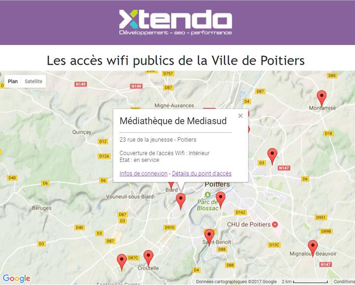
Positionnement des bornes wifi publiques du service PublicWifiPoitiers de Grand Poitiers.
Sa mise à jour est effectuée au fur et à mesure des installations et d'arrêt des bornes.
La 1ère publication correspond à la mise en service d'un 1er lot cohérent de bornes.
Origine
Les données ont été rentrées manuellement à partir du positionnement connu vis à vis du cadastre. Les points ne sont pas géoréférencé par GPS et sont donc positionnés au bâtiment près.
Organisations partenaires
Grand Poitiers, Grand Poitiers - DEPP - CA Valorisation des données
⚠️ This dataset is handled by the geo.data.gouv.fr platform. This platform is not actively maintained and as a result, you may find some bogus data or metadata. More information about the shutdown of geo.data.gouv.fr is available here.
January 24, 2020
Licence Ouverte / Open Licence version 2.0
Data description filled
Files documented
License filled
Update frequency not set
File formats are open
Temporal coverage not set
Spatial coverage filled
All files are available
Update frequency not set
Temporal coverage not set
Visualization
Published on December 29, 2017 by Xtendo
There are no discussions for this dataset yet.
There are no community resources for this dataset yet.
5513078b88ee3856407c596c
March 25, 2015
Unknown
January 24, 2020
Other
{46171833-C42D-4BA9-B1AC-7EC417537386}
52ed6f1f9ed94a50d977b85d9e16e428e713b842
{F8149235-0F45-420D-A0A0-840F4AE26066}
shutdown-phase-2
411
154
1
0