Plan IGN
Description
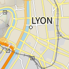
Plan IGN est un fonds cartographique IGN complet pensé entièrement pour un usage écran. Il est constitué de 19 niveaux de zoom qui cartographient avec précision et lisibilité la France de l’échelle monde au 1 : 1000 environ tout en proposant un contenu cartographique riche à grande échelle, notamment en zone urbaine.
Producer
Latest update
April 29, 2024
License
License Not Specified
Metadata quality:
Data description filled
Files documented
License filled
Update frequency not set
File formats are open
Temporal coverage filled
Spatial coverage filled
All files are available
Metadata quality
Update frequency not set
There are no reuses for this dataset yet.
There are no discussions for this dataset yet.
There are no community resources for this dataset yet.
Information
Tags
License
License Not Specified
ID
61488c8c6c3e156d4c83f979
Temporality
Creation
September 20, 2021
Frequency
Unknown
Temporal coverage
2020/06 to 2020/12
Latest update
April 29, 2024
Spatial coverage
Territorial coverage
France
Territorial coverage granularity
Other
Actions
Embed
Statistics for the year
Views
5.6k
Downloads
2.1k
Reuses of this dataset
0
Followers
1